
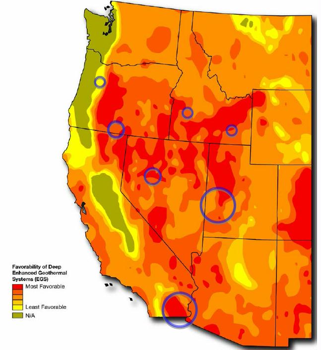
Source data for deep EGS includes temperature at depth from 3 to 10 km provided by Southern Methodist University Geothermal Laboratory (Blackwell & Richards, 2009) and analyses performed by NREL (2009) for regions with temperatures ≥150°C. Map does not include shallow EGS resources located near hydrothermal sites or USGS assessment of undiscovered hydrothermal resources. “N/A” regions have temperatures <150°C at 10 km depth and were not assessed for deep EGS potential.